All land in the municipality is covered by the Whitehorse Planning Scheme.
The Whitehorse Planning Scheme is a legal document that specifies how land in the municipality can be used and developed. The Planning Scheme contains the planning policy framework including State, regional and local planning policy, plus zoning maps, overlay controls, and other planning controls.
The local planning policies identify long term directions about land use and development in the municipality, presents a vision for its community and other stakeholders, and provides the basis for the zone and overlay requirements and particular provisions in the scheme.
The zone and overlay requirements and particular provisions discuss the type of use and development allowed in each zone, any additional requirements on land that is covered by an overlay and requirements for any specific uses and development.
On 21 November 2024, local policies in the Whitehorse Planning Scheme have been translated into the Planning Policy Framework (PPF), which aims to streamline the operation of planning policy in Victoria using a 3-tier structure that integrates state, regional and local policy.
While the planning scheme looks different, it is important to note that the policy intent has not changed. The PPF merges all policy content in the planning scheme into a single policy source.
You can view the Whitehorse Planning Scheme, including zone and overlay maps, on the Department of Transport and Planning (DTP) website
- Planning Scheme Amendments can be viewed below.
Zones and Overlays
Zones and Overlays within the Whitehorse Planning Scheme indicate how your land can be used and developed. Every property in Whitehorse is zoned. The main types of zones in the municipality are residential, commercial and industrial.
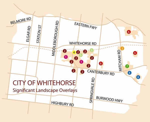
Some properties also have overlay controls. Overlay controls protect important features like heritage buildings and vegetation, or show areas that need special care, like areas that are prone to flooding.
To find out what zone or overlay applies to your property, refer to Whitehorse Maps.
You should check the zone or overlay if you plan to buy a home, develop land, change how land is used or renovate your property.
Review of the Planning Scheme
The Planning and Environment Act 1987 requires that each council must review their planning scheme every four years, within a year of adopting the Council Plan. The review ensures that the Planning Scheme is up to date and addresses all the key issues that Whitehorse is experiencing or we may experience in the future.
The most recent Whitehorse Planning Scheme Review ( PDF 616.3KB) was endorsed by Council on 16 July 2018.
Whitehorse Planning Scheme Amendments
Planning schemes require changes from time to time to achieve certain planning outcomes, support new policies or strategies and to ensure that requirements continue to meet the needs of the local community.
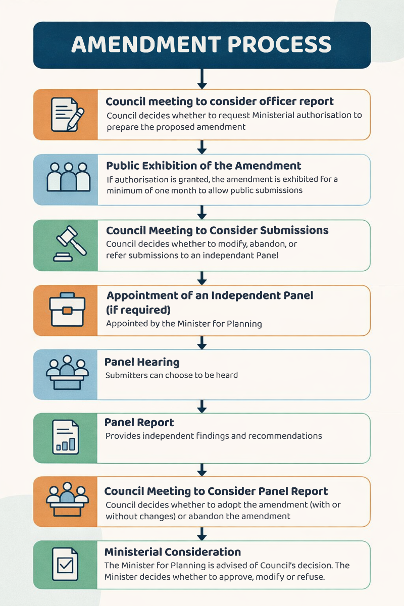
Planning Schemes are changed through a statutory process called a planning scheme amendment. An amendment may involve a change to a planning scheme map (for example, rezoning of land or the application of an overlay) or a change to the written part of the scheme (the ordinance), or both.
Planning scheme amendments are usually prepared by Council or the Minister for Planning as the ‘planning authority’ and must follow the process set out in the Planning and Environment Act 1987.
For more information on planning schemes and amendments visit the Department of Transport and Planning website at Planning Scheme Amendments online.